Valladolid in Valladolid
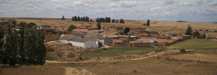
The province of Valladolid is situated in the centre of the autonomous region of Castilla y León in northeastern Spain. It enjoys the distinction of being the only Spanish province which is surrounded exclusively by other provinces of the same region: Burgos, Palencia, León, Salamanca, Avila, and Segovia. It is also the only province in Spain which is completely void of mountains. Nonetheless, its average height above sea level is 700 m – compared to for example Great Britain, where it is 75 m.
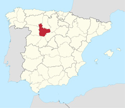 The province has been populated since pre-Roman times, although it has never been a very densely populated area. The average population density in Spain is 94 inhabitants per km2, in Valladolid it is less than 65. The population in 2020 constituted just over 1% of the total of people living in Spain, situating it 29th of the 50 Spanish provinces. The capital of Valladolid is Valladolid. It is home to almost 300,000 souls.
The region of Castilla y León does not have an official capital, but being the seat of the region’s courts and government, the city considers itself the capital of Castilla y León. In fact, from 1601 to 1606 Valladolid was the capital of the whole Empire of Spain.
Valladolid has other claims to fame: Here, Ferdinand III (known as Saint Ferdinand) was proclaimed king, the Catholic Majesties’ wedding took place in Valladolid, Henry IV, Philip II, Philip IV and Ana de Austria (queen of France) were born here. In Valladolid, Magellan planned the first travel around the world, in which he discovered the natural passage between the Atlantic and Pacific oceans which is now known as the Strait of Magellan. Christopher Columbus died and was buried in Valladolid before his earthly remains were moved to Seville, and Miguel de Cervantes finished writing the novel that was to become a point of reference for all students of literature: Don Quixote.
The Easter Week celebrations in Valladolid are amongst the most spectacular and visited in Spain, and the city is home to several museums, including the homes of the poet José Zorilla, Christopher Columbus, and Miguel de Cervantes. Its historic centre houses an abundance of palaces, noble houses, churches, plazas, avenues, and parks as well as the majority of the city’s museums.
The daily temperatures in Valladolid vary a lot between night and day, often with as much as 20 degrees difference. The annual average temperature is 12.7ºC. The winters are cold with frequent fogs and frosts – there is an average of 56 days with below zero temperatures a year. It snows an average of nine days a year. The fog that is produced during the long December and January nights often does not disperse all day, and hoarfrost is a frequent visitor in the winter months. The summers, on the contrary, are hot and dry with maximum temperatures between 30 and 35ºC, although the nights are usually mild and comfortable with an average minimum temperature of 14ºC.
Although Valladolid is several hundred kilometres from the coast, it nonetheless boasts its own beach, Playa de las Moreras. It is an artificial beach with a large area of sand leading down to the Pisuerga River which traverses the city. There, the city folk can sunbathe and frolic, and even have a swim in the river.
Although the province’s economy is very much dominated by agriculture and livestock production due to the flatness of the land, Valladolid Capital has only 1% of its working population employed in these sectors. The largest economic sector in the city is the services sector which employs almost 105,000 people, 72.7% of the registered work force. Within the services sector, the retail trade of non-comestible products presents over 50% of the total. The industry and construction sector is also an important player in the city’s economy giving jobs to just over 22,000 workers.
Bilbao in Biscay
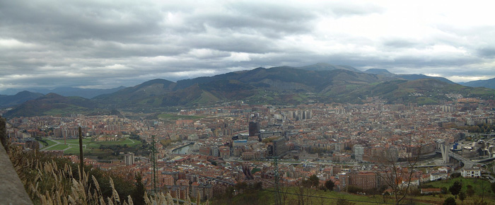
Biscay province lies on the south shore of the eponymous bay. The name also refers to a historical territory of the Basque Country, heir of the ancient Lordship of Biscay. Its capital city is Bilbao. It is one of the most prosperous and important provinces of Spain as a result of the historical trading importance of its commercial ports after the middle ages and the massive industrialization during the last quarter of the 19th century and first half of the 20th century. Since the deep de-industrialisation of the 1970s, the economy has come to rely more on the services sector.

Biscay is bordered by the community of Cantabria and the province of Burgos (in the Castile and León community) to the west, the Basque provinces of Gipuzkoa to the east, and Álava to the south, and by the Cantabrian Sea (Bay of Biscay) to the north. Orduña (Urduña) is a Biscayan exclave located between Alava and Burgos provinces.
The climate is oceanic, with high precipitation all year round and moderate temperatures, which allow the lush vegetation to grow. Temperatures are more extreme in the higher lands of inner Biscay, where snow is more common during winter. The average high temperatures in main city Bilbao is between 13 °C (55 °F) in January and 26 °C (79 °F) in August.
The southern high mountain ranges, part of the Basque mountains, that form a continuous barrier with passes not lower than 600 m AMSL, forming the water divide of the Atlantic and Mediterranean basins. These ranges are divided from west to east in Ordunte (Zalama, 1390 m), Salbada (1100 m), Gorbea (1481 m) and Urkiola (Anboto, 1331 m).
The middle section which is occupied by the main river's valleys: Nervion, Ibaizabal and Kadagua. Kadagua runs west to east from Ordunte, Nervion south to north from Orduña and Ibaizabal east to west from Urkiola. Arratia river runs northwards from Gorbea and joins Ibaizabal. Each valley is separated by medium mountains like Ganekogorta (998m). Other mountains, like Oiz, separate the main valleys from the northern valleys. The northern rivers are: Artibai, Lea, Oka and Butron.
The coast: the main features are the estuary of Bilbao where the main rivers meet the sea and the estuary of Gernika (Urdaibai). The coast is usually high, with cliffs and small inlets and coves.
Biscay has been inhabited since the Middle Palaeolithic, as attested by the archaeological remains and cave paintings found in its many caves. The Roman presence had little impact in the region, and the Basque language and traditions have survived to this day.
Biscay was identified in records of the Middle Ages, as a dependency of the Kingdom of Pamplona (11th century) that became autonomous and finally a part of the Crown of Castile. The first mention of the name Biscay was recorded in a donation act to the monastery of Bickaga, located on the ria of Mundaka. According to Anton Erkoreka, the Vikings had a commercial base there from which they were expelled by 825. The ria of Mundaka is the easiest route to the river Ebro and at the end of it, the Mediterranean Sea and trade.
In the modern age, the province became a major commercial and industrial area. Its prime harbour of Bilbao soon became the main Castilian gateway to Europe. Later, in the 19th and 20th centuries, the abundance of prime quality iron ore and the lack of feudal castes favoured rapid industrialisation.
Zaragoza in Zaragoza
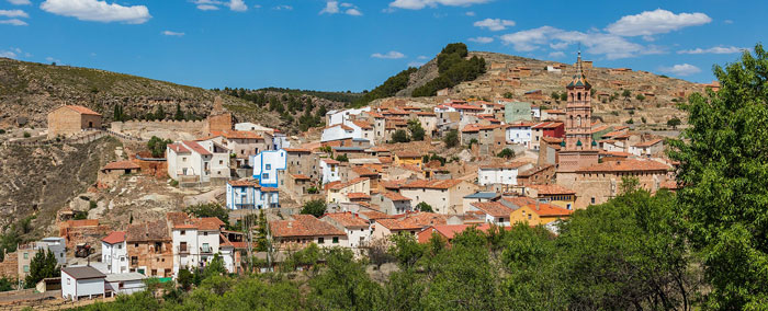
Zaragoza, also called Saragossa in English, is a province of northern Spain, in the central part of the autonomous community of Aragon. Its capital is Zaragoza, which is also the capital of the autonomous community. Other towns in Zaragoza include Calatayud, Borja, La Almunia de Doña Godina, Ejea de los Caballeros and Tarazona.
 The province of Zaragoza is bordered by the provinces of Lleida, Tarragona, Teruel, Guadalajara, Soria, La Rioja, Navarre, and Huesca. The southern and western side of the province is in the mountainous Sistema Ibérico area and includes its highest point, the Moncayo, while the northern end reaches the Pre-Pyrenees. The Ebro River crosses the province from west to east.
Its area is 17,274 km2 and it is the fourth-largest Spanish province by land area. Its population was 954,811 in 2018, accounting for slightly over 72% of the entire population of Aragon; nearly 75% of those lived in the capital. Its population density was 51/km2. It contains 292 municipalities, of which more than half are villages with fewer than 300 people.
The main language throughout the province is Spanish (with official status), although Catalan is spoken in the Bajo Aragón-Caspe comarca and in Mequinenza municipality.
The city of Zaragoza lies at an elevation of about 208 metres (682 feet) above sea level and hosted Expo 2008 in the summer of 2008, a world's fair on water and sustainable development. It was also a candidate for the European Capital of Culture in 2012.
The city is famous for its folklore, local cuisine, and landmarks such as the Basílica del Pilar, La Seo Cathedral and Moorish Aljafería. Together with La Seo and the Aljafería, several other buildings form part of the Mudéjar Architecture of Aragon which is a UNESCO World Heritage Site. The Fiestas del Pilar are among the most celebrated festivals in Spain.
Zamora in Zamora

The province of Zamora is situated in the north-eastern part of Castilla y León. It borders on the provinces of León, Valladolid and Salamanca and, to the west, the region of Galicia and Portugal.
With its 10,560 km2, it represents 2.1% of the surface of Spain, whereas the population of 170,588 represents only 0.36% of the total population of Spain. The population density of Zamora is just 16.15 souls per km2 compared to the national average of 94.
The province is divided up into 248 municipalities, and more than half of these have less than 250 inhabitants. In fact, only 15 municipalities have over 1,000 inhabitants, and just three more than 5,000.
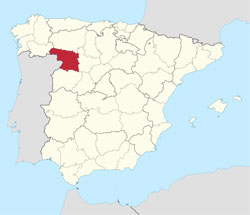 The highest point in Zamora is Peña Trevinca in the extreme northeast of the province at 2,127m above sea level, and the lowest in the township of Fermoselle at 330m above sea level
Zamora is also home to the Sierra de la Culebra hunting reserve which boasts large numbers of deer and wild boar as well as Spain’s most numerous population of the Iberian wolf.
The capital of Zamora is Zamora The city is situated centrally in the province at a height of 652m above sea level, which makes it the lowest capital of the region of Castilla y León. The population of Zamora does not quite reach 61,000, which places it as Spain’s 7th least populated capital.It is rich in history and historic monuments.
The old quarter has been denominated of historic-artistic value since 1973. In the heart of this is the historic centre, which is an elongated area, almost completely surrounded by the old city walls. It is situated on a rocky mesa, over 26 meters high, which borders on the Duero River. The Duero River runs through the city from east to west, dominating the cityscape.
One of the city’s most important features is its range of Romanesque buildings which are spread all over the city and represented by no less than 23 churches; 14 of these can be found in the historic centre.
This Romanesque heritage also includes a castle, the city walls, a bridge, two palaces and nine houses, as well as the cathedral. The city of Zamora is, not without reason, called the Romanesque City.
There are eleven Romanesque cathedrals in Castilla y León, and the Cathedral of Zamora is distinguished by being the oldest and the smallest. Zamora was the first city in the world to have global Wi-Fi cover, and it received the title Zamora Hot City (the Nobel Prize of informatics), although the cover left a lot to be desired and finally disappeared altogether and left about 1,500 users without cover.
The climate in Zamora can be described as a steppe climate, with scarce rain which falls mainly in autumn and spring, cold winters, and hot summers with minimal or no rainfall. The winters often see days on end of mist caused by the Duero River, which reduces the temperature even more.
The Easter Processions of Zamora are considered amongst the most important and spectacular in all of Spain. The ‘Procesión del Yacente’ is often placed at the top of the list for Spanish Easter processions; only the distant bells from the church and the sound of the torch ends striking the ground break the silence as this solemn procession passes through the streets of the city to Plaza de Viriato where it ends with a poignant rendition of the Miserere.
Zamora is well visited by tourists; however, the majority of these consider it a place to pass through on the way to or from somewhere else, and only about half of the visitors actually spend one or more nights in the city. 80% of the tourists come from Spain, mainly Madrid, Catalonia, and the Basque Country.
Valencia in Valencia
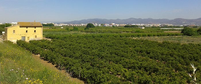
Valencia is the northernmost province in the autonomous region of the same name. It borders on the Mediterranean Sea to the east, on the provinces of Castellon and Teruel to the north, Cuenca and Albacete to the west and Alicante to the south. It also has a small exclave, Rincón de Ademuz, squeezed in between Cuenca and Teruel provinces.
The province of Valencia is undoubtedly best known for its capital of the same name and its endless sandy beaches and tourist resorts. But the province also has a beautiful interior well worth seeing. It is dominated by mountain ranges such as the Iberian and the Betica ranges. The highest point in the province is Pico Calderón in the Macizo de Javalambre. It reaches 1,838 MASL and is situated between Valencia and Teruel; it is a fairly easy hike to get to the top which is a popular destination amongst trekkers.
 The many mountain ranges are traversed by great rivers which have created steep valleys and a large mesa in the middle of the province which has an average altitude of 750 MASL. The province of Valencia also boasts Spain’s second largest coastal plain set between the rivers Júcar and Turia along their lower stretches. The capital of Valencia, Valencia, is home to more than 800,000 of the provinces 5,045,885 inhabitants, which makes it Spain’s third largest city after Madrid and Barcelona.
Valencia is also the capital of the whole of the autonomous community of Valencia which comprises the provinces of Castellon, Valencia and Alicante. The city of Valencia, which is situated on the banks of the river Turia near its estuary as it flows into the Mediterranean Sea, has been an important population centre for more than 2,000 years. It was founded by the Roman consul Decimus Junius Brutus Callaicus in 138 BC. About 2,000 colonists settled on the site of a former Iberian settlement, and their descendants formed one of the so-called ‘fully Romanised cities’ in the Roman Hispania with nearly all the population made up by descendants of Romans from the Italian peninsula. When the Roman imperial administration crumbled, Valencia lived through a couple of tumultuous centuries with hardly any new developments in the city until the advent of the Moors. The city prospered once again under Muslim rule and did booming trade in paper, silk, leather, ceramics, glass, and silver work. After many Christian attempts, Valencia was finally conquered back into the Christian fold by King James I of Aragon in 1238. Fifty thousand Moors were forced to leave, and after the expulsion the city was divided between those who had participated in the conquest. Valencia lived through its golden age in the 15th century. It was a time of economic expansion, and culture and the arts flourished. However, when the Americas were discovered in 1492, all of Europe’s trade and interests turned west, and Valencia entered into a long decline which was not to reach its nadir until more than 200 years later. Under Bourbon rule, the city started its long upwards climb back to prosperity, which was to increase almost non-stop, even up until the present day.
The climate in Valencia is hot in summer and mild in winter. January is the coldest month, but snow and below-zero temperatures are rare. The hottest month is August with the average maximum temperature in the early thirties, the average minimum in the early twenties. Rain is most abundant in September and October and is usually about 500mm a year, although later years, through climate change, have seen massive downpours – like only last month when the city and province in one day registered rainfall of up to 200 mm, the majority of it in just one hour. During sudden rainfalls like that, the river Turia overflows and floods parts of the city. Valencia has two urban beaches with fine, golden sand: Playa de las Arenas and Playa de la Malvarrosa, which border to the south on the large port of Valencia. These two city beaches have a long seafront promenade lined with numerous premises offering places to stay and local gastronomy. The beaches south of the Turia river are less bustling and offer a 15 km stretch of sandy coastline, protected by dunes and surrounded by the Albufera natural park. The Port of Valencia is an important and integral part of the city. With a total ground area of 5,603,186 m2 and 13,232 meters of docking distributed on 15 piers, it is the largest port in Spain and the whole Mediterranean basin, and the fourth busiest port in Europe. It has a loading capacity of 64 million tons a year, or 6,660,947 TEUs. More than 15,000 employees in the port area administer, service, load, and unload over 7,500 ships a year. Valencia also has a thriving economy in the areas of commerce, industry, tourism and other services and is visited by more than 10 million tourists a year, not least boosted by the city’s prestigious Ciudad de las Artes y las Ciencias, an enormous architectural, cultural and entertainment complex with a stunning design.


